A KINGSTON WALK – Commentary by Ed Miller, based on the work of Richard Standing, the author of many books and articles on Kingston and East Preston.
The name Kingston shows that it was once part of a royal estate (pre-1066, then given to Roger de Montgomery, cousin of Wiliam the Conquerer). Kingston has been closely connected with Ferring for many centuries and was probably one of the hamlets served by the ‘Minster’ church from the 8th Century. It never had more than half the population of Ferring. Its Chapel was washed away by the sea, along with most of its houses, in the 17th Century, and the remaining population attended Ferring church thereafter. In 1913 it was formally attached to East Preston, when that parish separated from Ferring. After 1918 the margins were developed for housing but most of it remains as farmland.
Our walk starts at the Bluebird Café car park and the gate to the west bank of the Rife (a Sussex name for ‘stream’). The boundary between Kingston and Ferring still follows the old course of the Rife, before the lower stretch was straightened and the outfall moved from west of the Café (built 1928) to east of the café in the 1950s. Thus parts of the ‘Kingston’ bank are actually in Ferring, and vice versa.
The outfall was regulated from at least the 1830s (a reference to ‘Ferring sluice’), presumably to improve drainage at low tide and prevent flooding at high tide. The sluice was probably maintained by the landowners. Fifty years earlier the Rife ran out through a delta of several channels, and the lower flanks of the river were ‘saltings’, grazed by sheep, and the designation still appeared on the 1932 large-scale maps. Now the sluice is kept free of the weeds that would otherwise choke it, by an elaborate and ugly screening-and-removal apparatus. The reference to Ferring Sluice was in a report of a smuggling case – 50 tubs of spirits – 1839. We will come back to that at the end of the walk.
As we walk further up the Kingston bank we can see that flooding (here from the river not the sea) remained a problem – the 1932 map describes the fields to the west as ‘liable to flooding’ – but the built-up embankments and the overspill lagoons created in 1988 seem to have finally brought it under control. The small ponds within the otherwise dry lagoons were developed by Ferring Conservation Group as habitats for wild life, and the lagoons themselves support a good population of ‘Early Marsh’ and other orchids. The Group has planted hundreds of small trees on the upper bank, and the whole area is a designated a Local Wildlife Site, managed by the Environment Agency.
Beyond the area liable to flooding (more grazing) was the arable land belonging to East Kingston Farm (Manor Farm), the southern part now covered by housing but the northern part still under crops and showing the old flint walls of the ruined Park Barn (named from a field of Kingston Farm called ‘The Park’).
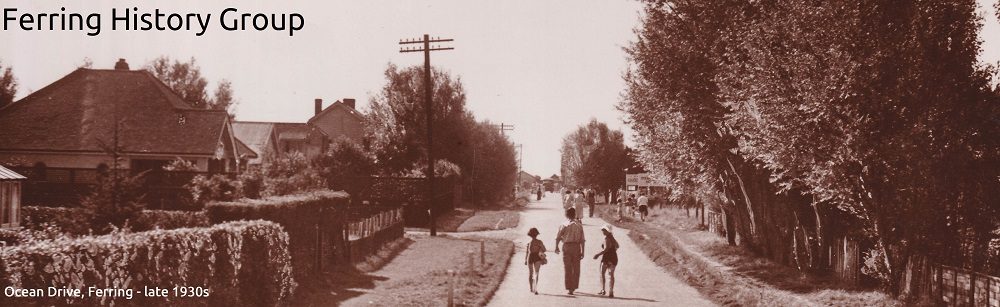
We come to the Footbridge and paths to Kingston village and chapel on the west, and to Brook Lane and Ferring village on the east. Note that the stream was only known as ‘the Rife’ in the 20th Century. ‘The Brook’ was the earlier name for the stream and ‘The Brooks’ the earlier name for the whole area of the stream and its marshy banks. The lower Ferring bank was known as the ‘Horsemarsh’ for many years. The path between Kingston and Ferring was much used.
50 m below the footbridge on the east bank a hoard of Bronze Age axe-heads was found in 1983. And just below that in 1984 archaeologists found evidence of an ancient trackway with cut branches of local trees, probably from 1000 BC (Bronze Age), and charcoal and burnt flints from the same period, indicating cooking fires.
The next bridge, now wide enough for vehicles calling at Ferring Country Centre, carried the footpath from Ferring to East Preston. One regular user was the Vicar, or his curate, coming from Ferring Vicarage up what is now ‘Rife Way’ to take services at East Preston church, where, until 1913, Ferring clergy officiated. For this reason it is sometimes known as the Parson’s Path. That path continues, as does our walk, along a tributary stream coming in from the west. The boundary between Kingston and Ferring follows this path before it heads north across the fields to ASDA: beyond that it is the boundary between Kingston and Angmering.
Where this path reaches Kingston Lane, there is a flint-built farmhouse (now just residential) previously known as West Kingston Farm. Richard Standing says, ‘Rose Cottage, a tiny building which has been restored, dates from the early 19th century, and was all that existed until 1901 when Mrs Gordon had ‘The Bungalow’ built. This was removed in 1996 when the present small estate was planned, with the large flint barn also converted. The Hills family lived at Rose Cottage in the late 19th century, employed on West Kingston farm’.
Turning south down the lane we come to Kingston Manor – sometimes referred to as ‘New Kingston Manor’ or ‘West Kingston Manor’. New, because the house was built only around 1820 and West because the single landholding that was the manor estate was divided between two cousins in the Olliver family at that time. William Olliver (1740-1820) took the western half and his George Olliver (1750-1809) the eastern half. George lived at the original Manor House at East Kingston, which came to be known as East Kingston Farmhouse. George had no surviving son, and so his share went to to his sister’s husband Samuel Henty (who was a cousin of the Ferring Hentys). William’s share, with a house that came to be known as Kingston Manor, descended to his son George (1766-1831) and eventually to the Gordon family. All these Ollivers have monuments in Ferring Church.
Kingston Manor and its outbuildings are almost impossible to see from the road but the small octagonal gatehouse is easily seen (the modern entrance gates are some 50 yards to the south). The last descendants of the Olliver family – the Gordons – lived here in the 20th Century. Frances Gordon, who fervently opposed the separation from Ferring Parish in 1913, died in 1933. Her son John Gordon died in 1942 and is buried, along with the rest of the family, in Ferring churchyard. His widow lived on at Kingston Manor until 1994.
It is Grade II Listed: ‘Early C19. Two storeys and attic. Three windows. Two dormers. Faced with Roman cement, the ground floor rusticated. Stringcourse, cornice and balustraded parapet. The windows are flanked by pilasters and those on the first floor have moulded architrave surrounds. Glazing bars intact. Porch up four steps with round-headed coved doorway and round-headed windows in its flanks. On each side of the main block is a contemporary wing of one storey with splayed angles, flanked by pilasters and faced with square knapped flints between the pilasters. Each wing has one tripartite window and a balustraded parapet over’. The house cannot be seen from the road but a Google aerial view gives some impression of the building and its surrounding parkland, both very well maintained.
Further down Kingston Lane, at the bend, Peak Lane (Pig Lane earlier) continues towards the lost village – earlier still it was known as ‘The Street’. Kingston Lane originally ran directly opposite, northwards but it was shifted to the west so as to by-pass Kingston Manor.
The lost village is another long story. It ran down this lane to another lane eastwards along the beach, with probably about 15 houses and a Chapel. The sea kept advancing on it, and by 1641 the Chapel was ‘utterly ruinated’ by the sea, and was abandoned and dismantled. Most of the cottages were washed away over the following decades, although. A few cottages survived down this lane, well north of the old seafront, in the 20th Century.
Round the bend Kingston Lane continues to East Kingston Farmhouse – the original manor house, and what was Manor Farm. The present building is mid-18th Century with later additions but probably incorporating an older building on the east side. Some of the old farm buildings are behind high walls but as you walk up the lane you see an old open-fronted barn (a ‘hovel’) on the right and a barn on saddle stones, which kept the damp, and rats out. At the left-hand bend is ‘The Old Cottage’ (very striking for its low thatched roof) for some of the farm workers. The lane continues up past a few more modern cottages towards the Rife and the footpath to Ferring.
We turn round at this point, back to the farmhouse and left into Sea Lane. Just south of the junction is the Kingston War Memorial, erected by the owner of the farm at the end of the First World War, J S Candy. There are only four names (none for the Second World War) – three of Mr Candy’s farm workers and one of his sons. Philip Candy was a Midshipman on HMS Monmouth when it was sunk with all hands at the Battle of Coronel, off Chile, on 1 November 1914. He was 15 years old.
The road leads down to the early-20th Century housing development of Kingston Gorse, built after J S Candy sold to a developer in 1918. A notable building on the left is the Water Tower built to serve the estate but now converted into a residence. On the right at the end of the lane is ‘The House on Stilts’ (more correctly, Sea Lane House, a Listed Building designed by a leading Modernist architect of the day, Marcel Breuer. It was built in 1936.
We then come to ‘Lighthouse Cottages’ at the seafront. There was never a lighthouse here – only a semaphore signal station, in the Napoleonic Wars, long since destroyed. The cottages may have housed the signallers but they were later used as farm cottages – two of the WW1 dead had lived here, another in ‘The Old Cottage’.
The road would have continued south for some 50 yards and then swung round east to run parallel with the present shoreline before meeting the continuation of Peak Lane. All this is now under the sea. Richard Standing has mapped the likely position of the old lost village using the alignment of the roads and footpaths and the location of a well, excavated in 1980 and 1981. It seems to have lain some 250 yards south of the present shoreline, and no other trace of the village or the chapel has been found. The ‘Black Rocks’, at twice that distance, have nothing to do with the village, except as a general indicator of the direction in which it lay.
After a period of stormy weather the churchwardens had to report in 1626; “Our chappel is much decayed and out of repayre by reason of the sea, and now hath wrought away the land in a manner to the very chappell so that it is not reapyrable. And being allotted to the mother church of Ferring, we most humbly desire order may be granted unto us to take downe the covering and healing of the chappell, which is of good and large Horshan stone or slate and enable the parryshioners for the preserving of the stone and timber worke for the yearly and continuall benefitt of the poore, for suddenly the chappell will be ruinated by the sea.”
The very last church presentment for Kingston dated 1641, reports “Our Chappell is utterly ruinated and demolished by the sea, and wee doe constantly resort to Ferring to service being the mother church.”
The walk turns left and continues along the greensward of Kingston Gorse, and back to the Bluebird Café. There are a few more historical points to be noted. First, there was some kind of port at Kingston in the middle ages. Although there is an obvious danger of confusing it with Kingston Buci, close to Shoreham, there is a petition in the National Archives from 1375, asking the the Chancellor to discharge two customs officers at Kingston, Sussex and appoint in their place William ate Vicarys of Ferring and John Pakkeman of Goring by Sea. The Customs Officers would have been collecting duties on the export of wool – and the first smugglers were taking goods out of the country, not into it. The port was probably no more than a landing stage or Stathe, and one of these is marked at Kingston on the Armada` Defences map of 1588, along with the beacons, just inshore. The positions marked are not precise but probably lay at the eastern edge of the lost village.
Next, the Second World War defences. There was a minefield at the top of the beach, and ‘Admiralty scaffolding’ between high- and low-water mark. Some of these scaffold poles came to light in early 2014, when strong winds and waves removed tons of shingle from the foreshore. The exits from the greensward were also laid with explosives. In late 1944 a resident wrote to the Regional Controller:
Ashton Kingston Gorse East Preston
13 10. 44
Dear Sir
Forgive me again for appearing importunate but I just cannot understand the situation that has arisen relative to the beaches here. For eighteen months there has been a notice at the entrance to the beach ‘Cleared Area’. For over two years the military and the Nursing Sisters of the RAMC have bathed here and used the beaches freely. Since your letter and following one from your Department to the District Council giving a seeming OK, these entrances have been closed and RE WIRED. Further, the notice affixed showing a cleared area has been removed. Is this as it should be or is there some lack of liaison?
With all this fear and trepidation I may now say that despite frequent applications in writing, and by verbal methods, there remains buried at my gate a few sticks of dynamite to blow up the road where needed and although the fuse is easily handled no one has as yet bothered to remove it.
Yours faithfully
B D Davis
Ten years after the war a Sea Hawk, jet fighter-bomber from the Fleet Air Arm station at Ford, crashed onto Kingston Beach at low tide, mortally injuring the pilot, who had bailed out. When the storms stripped the shingle away in 2014 it revealed the tail fin washing about in the water. Some of us from the History Group tried to recover it but when went back to load it up onto a sledge it had disappeared below the shingle again.
Finally, back to smugglers. There are several records of confrontations between the Revenue Officers and gangs landing spirits at Ferring and Kingston. One from 1735 says, ‘information was received that a parcel of brandy was to be run ashore at Kingston and, going in pursuit of it, the officers met with ten smugglers, one of whom presented a pistol but the officers got the better of the smugglers and carried the brandy to the custom house’. Another is from the Brighton Gazette in November 1839: ‘An attempt was made to run about 50 tubs of contraband spirit ashore at Ferring Sluice, a little before noon on Sunday, when it was known that most of the Kingston Station would be at church. Intimation, however, reached the the man on duty of what was going on and, an alarm being made, 41 tubs and three men – named Wicks, Green and Cheeseman – were captured. The tubs were previously sunk near the shore, with a line attached to a stone at low water mark’.
Smuggling died out in the 1840s because import duties were greatly reduced. But Ferring Sluice had no doubt been a convenient place to land contraband, enabling the smugglers to get the goods away by cart up the Ferring side of the Rife, or even by punt or raft up to Brook Lane. It is now a convenient place to end the walk, with a cup of tea at the Bluebird Café (built in 1928).