If you were not able to join us on our 2015 New Year’s Day Walk, here are some notes which might help to do this three-mile walk, nearly all on footpaths, yourself, seeing something of the history of the village.
Begin at the Bluebird Café car park (turn left at the junction of South Drive and West Drive). Behind the cafe, take the footpath on right-hand side of the ‘Rife’. The stream is the western boundary of the parish, and of the old Manor of West Ferring (on a 1621 map, and probably since Saxon times). As you walk upstream, Highdown Hill comes into view. At the top are the traces of the earliest Ferring settlers, the Bronze Age people who 3000 years ago built the bank and ditch, later made into a hill fort in the Iron Age. They used the path you are walking on – remains of the saplings they cut down to make a trackway, with the knife marks still on them, were excavated here in the 1980s. Just before you reach the footbridge is the site of a more spectacular find – the hoard of bronze palstaves (axe heads) now in Worthing Museum. We can only guess at how they came to be buried on the river bank. They were certainly not thrown away – they look as good as new – and may have been a votive offering to a river god.
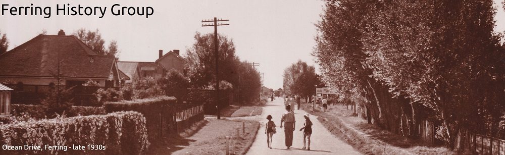
At the bridge turn right, up the footpath into Brook Lane, originally the continuation of the Kingston-Ferring footpath but now a metalled road lined by 1930s houses, which takes you to the village centre. You are walking through rich arable farmland – until the early 1800s this was the ‘Common field’ in which villagers held one-acre strips. At the corner of Brook Lane, on the left is the late-18th century Home Farm House, and on the right a garage dating from 1930. Behind that are Home Farm Cottages, and beyond that a builder’s merchant whose main showroom is one of the old Home Farm buildings. The name ‘Home Farm’ dates from the 1890, when Edwin Henty inherited from his father the ‘big house’, Ferring Grange, which we shall come to in a few hundred yards, and the estate of some 400 acres. He took this farm ‘in hand’ (the others he left with tenant farmers) and took some personal interest in it.The farm was mainly arable and comprised most of South Ferring. Sold for housing development in 1923, some of the farm cottages and barns (adapted to other uses) still survive.
Cross the road and through the churchyard. St Andrews Church is named in a deed of 791, when Eadwulf gave a piece of woodland to support the church – that is to say the original Saxon building, probably wooden. The present stone church is only 800 years old. The churchyard has many headstones from the 18th century but it had been used for hundreds of years before that. The Parish Register, detailing the burials, survives from 1558 but there must have been burials here from the time the Saxons abandoned their cemetery up on Highdown (excavated in modern times, and much material again on display in Worthing Museum).
The house in the north-west corner of the church yard, by the lych gate, is The Ramblers, home and workshop for the village undertaker at the turn of the last century. Opposite, across Church Lane, is a lovely row of old cottages. Holly Lodge, Church Cottage and Maytree Cottage. Erebus is a modern in-fill but blends in quite well. The others are at least 250 years old (note the plaque on Holly Lodge) but have internal features that suggest mediaeval origins. Opposite Maytree Cottage there is a small bay in the wall of the churchyard with a standpipe. This was the water supply for the cottages for many years.
At the end of the wall turn right up the unmade road. This was the entrance to Ferring Grange, and will take you round to what remains of the house. It was largely destroyed by fire in 1946 but what remained was converted to flats – the appropriately named Phoenix House. What we can see looks Victorian but on or very near this site was the old ‘Ferring Manor Place’, shown on the 1621 map and, no doubt, representing a succession of buildings from Norman times, where the Manor Court was held and the principal landowner lived. From 1790 the Henty family lived here and gradually bought up most of the rest of the parish. Edwin Henty (junior) died in 1916 and his widow sold off the Grange and Home Farm in 1923. She died in 1928 and the other half of the estate (i.e. most of North Ferring) was sold off soon after.
Come back down the drive. On your right is Grange Cottage, where Henty’s coachman lived (note the crest over the door). Up Ferring Street ahead of you, is another series of 18th century cottages, with the old Vicarage in the distance. This junction is the old village centre and, again, there are traces of much older buildings in their interiors. Using the modern names, Evergreen Cottage is first on the left, set back from the road. Then Smugglers Cottage, and its annex, and further down half-hidden by the trees is Yew Tree Cottage. On your right is ‘The Old Cottage’, much restored after fire damage in the 1930s.
Turn right in to Little Twitten Recreation Ground. The footpath is the old route to Goring – the piece of land was called Street Field on old maps. At Sea Lane we cross the road and turn right following the tarmac footpath (the old route continues eastwards through modern housing). East Ferring Farmhouse stood at what is now the Sea Lane/Midhurst Drive junction, where the Cortis family lived, from at least the 1820s to the 1901 census.
Just south of this site is the entrance to Ilex Way, the old carriage drive to Goring Hall a good 500 yards to the east. David Lyon (sometimes, but erroneously, said to be a relative of the late Queen Mother) had made his money from the sugar plantations in the West Indies. He built Goring Hall in c.1840 and evidently enjoyed laying out these carriage drives – another one linked the Hall to Goring Church, and another to the beach.
In the copse just south of this entrance are the remains of an even older farmhouse – Manor Farm, the ‘home farm’ of East Ferring Manor. It is tempting to assume that ‘East Ferring House’, across the road, but not easily visible behind its garden trees, is the manor house to which the farm was attached. This is not the case: parts of that house date back to the 16th Century but it belonged to the (West) Ferring manor, not the East Ferring manor (for a closer look, cross the road and walk a few yards up ‘East Mead’). The history of the East Ferring manor is still very obscure – only a few 18th Century records survive of the manor court or Lordship – but ‘East Ferring’ was identified as separate from Ferring or ‘West Ferring’ as far back as the 14th century. It was closely associated with Goring.
Back on the footpath, and walking on, we come to a fine group of old cottages – but some are much older than others. Bramble Cottage (thatched) is at least 18th century but the attractive ‘Magpies’ was built in its garden only in 1993 – Fern and Myrtle Cottages, with ‘Random Harvest’ complete this group. Further down, past the junction with Somerset Road is St Aubin’s Court. This was the site of the first modern house in Ferring – Wookyi-Tipi, built in 1922, and owned by the Guest family. Lionel Guest was Churchill’s cousin. He, and more particularly his American wife, became the centre of a smart social set in South Ferring in the 1920s. From St Helier Road down to the sea was another even larger house – St Malo, where the Prince of Wales stayed with his mistress, Freda Dudley Ward in 1928.
Continue on the path down to the sea front. Cross at the corner (watch the traffic), through the car park and turn right onto Pattersons Walk, which will bring you back to the Bluebird Café. At this point there was once a landing stage of some description. In the ‘Armada’ map of the South Coast (1587) it is marked as ‘Ferring Stade’, and there were beacons here, to signal inland if the Armada was sighted. In 1818 Edwin Henty (no less) was convicted of landing 300 tubs of smuggled gin here before taking it up to his barn in the village (his accusers were later convicted of perjury).
A landing of a different sort was on the cards in 1940, and 75 yards further on the preparations are very evident. The raised platform was added in the 1950s but the large cubic structure is a pill box for five light machine guns. The doorway and the three embrasures – one pointing out to sea, the others up and down the seafront are just visible in outline. The path you are walking on was the middle of a minefield, cleared (with every mine accounted for) by the Royal Engineers in October 1944.
But in this final part of the walk you might think about another invasion – that of the sea, which has been encroaching on the land here for at least 500 years. The high-water mark then was at least 250 yards south of where it is now. Much agricultural land was lost, and half a mile further west the chapel at Kingston was abandoned to the waves in the 17th century. The huge granite boulders placed here, and the thousands of tons of shingle added to the beach, around 2005, show that the problem has not gone away.
Note also the last two surviving of the big houses on the beach built in the 1920s and early 1930s – ‘Far Corners’ near the Sea Lane end and ‘Milbury House’ built for the actor Raymond Massey in 1927, and the garden wall of ‘Lamorna’ built for Lady Hulton in 1928.
And so we come back to the Bluebird Café, build in the late 1920s when Ferring was enjoying a boom in day trippers, holiday development and retirement bungalows. Go and have a cup of tea before you head home.